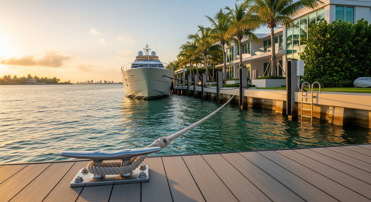
Shopping for a Bayshore waterfront home because you want your boat at your back door? Not all waterfront is created equal, and “deepwater” can mean very different things depending on your vessel. If you plan to moor a sportfish or motor yacht at home, getting this right is the difference between smooth weekends on Biscayne Bay and constant headaches.
This guide breaks down deepwater dockage in clear, practical terms tailored to Bayshore and the Sunset Islands. You’ll learn what “deepwater” really means for your boat, how tides and bridges come into play, what permits and structures to check, and how to evaluate a property with confidence. Let’s dive in.
What deepwater means for your boat
“Deepwater” is a practical concept, not a fixed legal depth. For you, it means water at your dock and along your route that allows your vessel to approach, turn, tie up, and depart safely at normal low tide.
Depths are referenced to tidal datums, most commonly Mean Lower Low Water (MLLW) or Mean High Water (MHW). Always ask which datum a seller or listing used. An “8 ft depth” at MLLW is far more useful than “8 ft” measured at high tide.
Translate any advertised number into usable depth for your boat. Start with your vessel’s maximum draft, then add a safety margin for under‑keel clearance. The margin varies by boat and conditions.
Key constraints at a glance
- Water depth at the dock: Confirm at lowest normal tide and verify the datum.
- Access to channels: Distance and route to the nearest dredged channel you can use.
- Bridge and overhead clearance: Low fixed bridges or lines can be limiting.
- Turning room: Space to swing and align with the dock safely.
- Seawall, piles, and dock rating: Structural capacity and condition, including boatlift compatibility.
- Permitting and environmental rules: Limits on dredging, dock size, and seagrass protections.
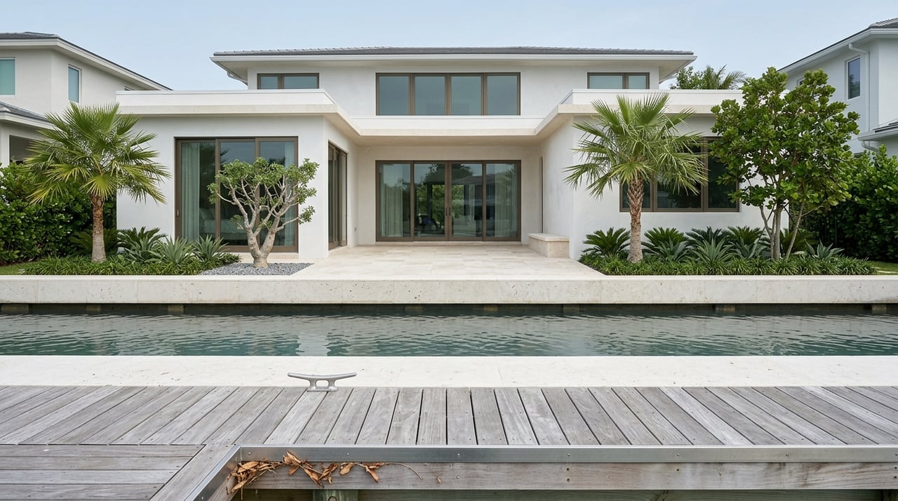
Bayshore and Sunset Islands navigation context
Bayshore and the Sunset Islands sit inside the Miami Beach lagoon system connected to Biscayne Bay. Some lots face open bay water while others sit on protected canals or basins. Each property is different, so treat access and depth as site‑specific.
Tidal ranges in the Miami area are generally modest, often about 1 to 2 feet. That still matters for deeper‑draft boats. The practical takeaway is simple: if a dock is listed as 8 feet, confirm that the measurement is at MLLW. If it was measured at high water, your usable depth at low tide could be 1 to 2 feet less.
For exact navigation planning, authoritative references include NOAA nautical charts for Biscayne Bay, local dredged channel information from the U.S. Army Corps of Engineers, and NOAA tide predictions for specific dates. Use these tools to confirm channels, aids to navigation, and expected depths on your route.
Verification sources to consult
- NOAA nautical charts and tide tables for Biscayne Bay.
- U.S. Army Corps of Engineers for federal channel depths and maintenance.
- Miami‑Dade and City of Miami Beach marine and permitting offices for local requirements.
Bridge clearance and approach considerations
Vertical clearance can be the limiting factor for sailboats and larger motor yachts with flybridges. Official publications list clearances relative to a tidal datum, often mean high water. In the Miami area, large causeways generally offer good clearance, while smaller canal bridges or utility lines may be lower.
There are three typical bridge types: fixed high‑span bridges, low fixed bridges, and movable bridges. Movable bridges operate on schedules and may require openings. Always confirm the vertical clearance and any opening procedures with the U.S. Coast Guard or local bridge authority.
Horizontal constraints matter too. Even with enough depth and vertical clearance, the width of the canal, the position of markers, and nearby shoals or seagrass beds can limit beam and turning radius. Larger yachts usually rely on marked federal channels rather than cutting across shallow flats.
Sizing the berth for your vessel
Use your vessel’s published maximum draft and beam as the baseline. Then add practical safety margins for comfortable maneuvering and changing conditions.
Typical ranges to guide your planning:
Small center console / bay boat (18–28 ft)
- Draft: 6–18 inches to about 2 feet
- Berth depth need: roughly 3–4 feet at low tide
- Maneuverability: high; narrow slips usually acceptable
Walkaround / smaller sportfish (28–38 ft)
- Draft: about 2–4 feet
- Berth depth need: roughly 3–5 feet at low tide
Offshore sportfisher / convertible (38–55 ft)
- Draft: about 3–5 feet
- Berth depth need: roughly 4–6 feet at low tide
Motor yacht / trawler (50–80 ft)
- Draft: about 4–8 feet
- Berth depth need: typically 6–9 feet or more at low tide
- Under‑keel clearance: often 1–2 feet minimum in protected maneuvers; increase to 2–4+ feet for comfort and safety as size grows
Large motor yacht / superyacht (80+ ft)
- Draft: about 6–12+ feet
- Berth depth need: often 8–12+ feet at low tide, plus generous turning basins
Additional rules of thumb:
- Under‑keel clearance: For small boats, plan 1–2 feet. For deeper drafts or current, plan 2–4+ feet. For large yachts, consult a local captain.
- Dock length: Aim for 10–20% longer than LOA to allow for lines and fenders.
- Beam and piling spacing: Confirm clear water width for safe fendering and crew access.
Quick depth math
If your 60‑foot motor yacht draws 6 feet, add a 2‑foot safety margin. You would target about 8 feet of depth at MLLW at the dock and along your approach. If the property only has 8 feet at high tide, it likely will not work.
Docks, seawalls, lifts, and permits in Miami Beach
Seawalls and docks in South Florida are regulated and must meet current codes for elevation and structural integrity. Older seawalls may require repair or replacement. Dock construction type and pile capacity determine what kind of boatlift you can install and what vessel loads the structure can handle.
Permits are critical. Activities seaward of the mean high water line may require approvals from the Florida Department of Environmental Protection, with additional permits from Miami‑Dade County and the City of Miami Beach. Dredging to deepen a private berth is heavily regulated and often triggers environmental review for seagrass, submerged lands, and protected species. Do not assume dredging is allowed.
What to request from the seller
- Recent property survey showing seawall and dock locations
- Copies of dock, seawall, and boatlift permits with dates and permit numbers
- Recent depth soundings at the dock and entrance, including the datum
- Engineering reports on seawall, dock structure, and any lift capacity ratings
- HOA or municipal rules on dock size, boat size, lift visibility, and overnight mooring
Condition and capacity checks
- Verify seawall age, materials, and recent repairs or replacements
- Inspect piles and connections for structural integrity
- Confirm power and water at the dock, including shore power type and amperage
- Check if existing boatlifts are permitted, their rated capacity, and maintenance history
How to evaluate a Bayshore property on site
Bring a simple checklist to every showing or have a captain walk the site with you.
On‑site items to confirm:
- Measure dock face length and clear water width between pilings
- Note depths at low tide if possible, or obtain MLLW‑referenced soundings
- Identify the nearest buoyed channel and estimate the route and distance
- Look for shoaling, sandbars, or visible seagrass that could affect access
- Check for overhead obstructions and bridge clearances on the route to Biscayne Bay
- Inspect seawall and dock for rot, spalling, loose pilings, and condition of utilities
Questions for the listing agent or seller:
- What is the depth at the dock, and which datum is it referenced to? When was it measured?
- How far is it to a dredged channel, and is the canal itself dredged or maintained?
- Are there any open permits, violations, or encroachments for the dock or seawall?
- Has the seawall or dock been rebuilt or repaired? Are there warranties?
- Are boatlifts installed or permitted? What is the lift’s rated capacity?
- Any known shoaling issues or dredging history with neighbors?
Operational questions for a local captain or harbormaster:
- Can the berth handle a vessel with your draft and beam at low tide?
- Is there sufficient turning room outside the dock under typical wind and current?
- Are there local timing practices for transiting in and out with deeper drafts?
Insurance, resilience, and long‑term planning
Marine insurers consider dock condition, seawall integrity, and approach risk. Shallow or awkward access can raise premiums or add exclusions. A quick check with your marine insurance broker early in the process can save time.
Miami Beach is a coastal environment, so plan for flood risk and future resilience. Consider whether the seawall height and condition align with your ownership horizon. Over a 10–30 year period, you may need upgrades such as seawall reinforcement or height increases. If you expect to add a large lift or rebuild a dock, get ballpark quotes and confirm permitting timelines before closing.
Common buyer scenarios in Bayshore
- 40–50 ft sportfish: Often workable at many Bayshore and Sunset Islands docks with about 4–6 feet at low water and a clear approach to a dredged channel. Verify turning room and lift capacity.
- 60–80 ft motor yacht with 6–8 ft draft: You typically need 8–10 feet at low tide, a dock face that matches LOA with extra handling room, and close access to a dredged channel. Many private docks can be marginal at this size without upgrades.
- Sailboat with mast above 60 ft: Vertical clearance is often the limiting factor. Confirm bridge heights and any utility lines on your route to Biscayne Bay before you proceed.
General guidance: if your vessel is over about 50 feet, engage a local captain or marine surveyor early to confirm suitability and estimate upgrade costs.
Your next steps
- Request the seller’s dock, seawall, and boatlift permit history and the latest survey.
- Obtain recent depth soundings at the dock and entrance referenced to MLLW.
- Walk the property with a licensed local captain or marine surveyor who knows Biscayne Bay.
- Check NOAA and U.S. Coast Guard data for channel depths and bridge clearances along your route.
- Confirm with Miami‑Dade County and the City of Miami Beach what permits or restrictions apply.
- Calculate under‑keel clearance using your vessel’s maximum draft plus a safety margin.
- Get a preliminary insurance read on the dock and vessel given access factors.
- If upgrades are likely, solicit ballpark quotes from marine contractors and confirm timelines.
Work with a senior‑led waterfront team
If you are weighing deepwater properties in Bayshore or the Sunset Islands, you deserve guidance from brokers who live and breathe Miami Beach waterfront. Our senior team brings rigorous on‑site inspection, disciplined due diligence, and the reach of a premier luxury platform to help you secure the right home for your boat and your lifestyle. Ready to evaluate specific docks and routes with confidence? Schedule a Private Consultation with The Corcoran Group.
FAQs
What does “deepwater” mean for a Bayshore motor yacht?
- It means having enough water at the dock and along the approach at normal low tide to safely maneuver your yacht, factoring in your maximum draft plus a safety margin.
How do tides in Biscayne Bay affect dock depth in Miami Beach?
- Typical tidal ranges of about 1 to 2 feet can reduce usable depth at low tide, so confirm whether any stated depth is referenced to MLLW or measured at high water.
Can I dredge to deepen my private dock in Miami Beach?
- Dredging is heavily regulated and may require state and local permits with environmental review; do not assume it is allowed until authorities confirm.
What permits apply to docks, seawalls, and boatlifts in Bayshore?
- Work seaward of mean high water often requires Florida DEP approvals plus Miami‑Dade County and City of Miami Beach permits, and boatlifts may need structural verification.
How do bridge clearances impact sailboats near the Sunset Islands?
- Low fixed bridges or overhead lines can restrict tall masts, so confirm vertical clearances relative to mean high water and any bridge opening schedules on your route.
What documents should I request when touring a waterfront home?
- Ask for recent surveys, dock and seawall permits, lift permits and ratings, recent depth soundings with datum, engineering reports, and any HOA or municipal rules.
How do I estimate if my dock can fit a 45 ft sportfisher?
- Check for roughly 4–6 feet at low tide, confirm turning room and clear width, and aim for a dock face about 10–20% longer than LOA for safe lines and fendering.